About New Hope Group
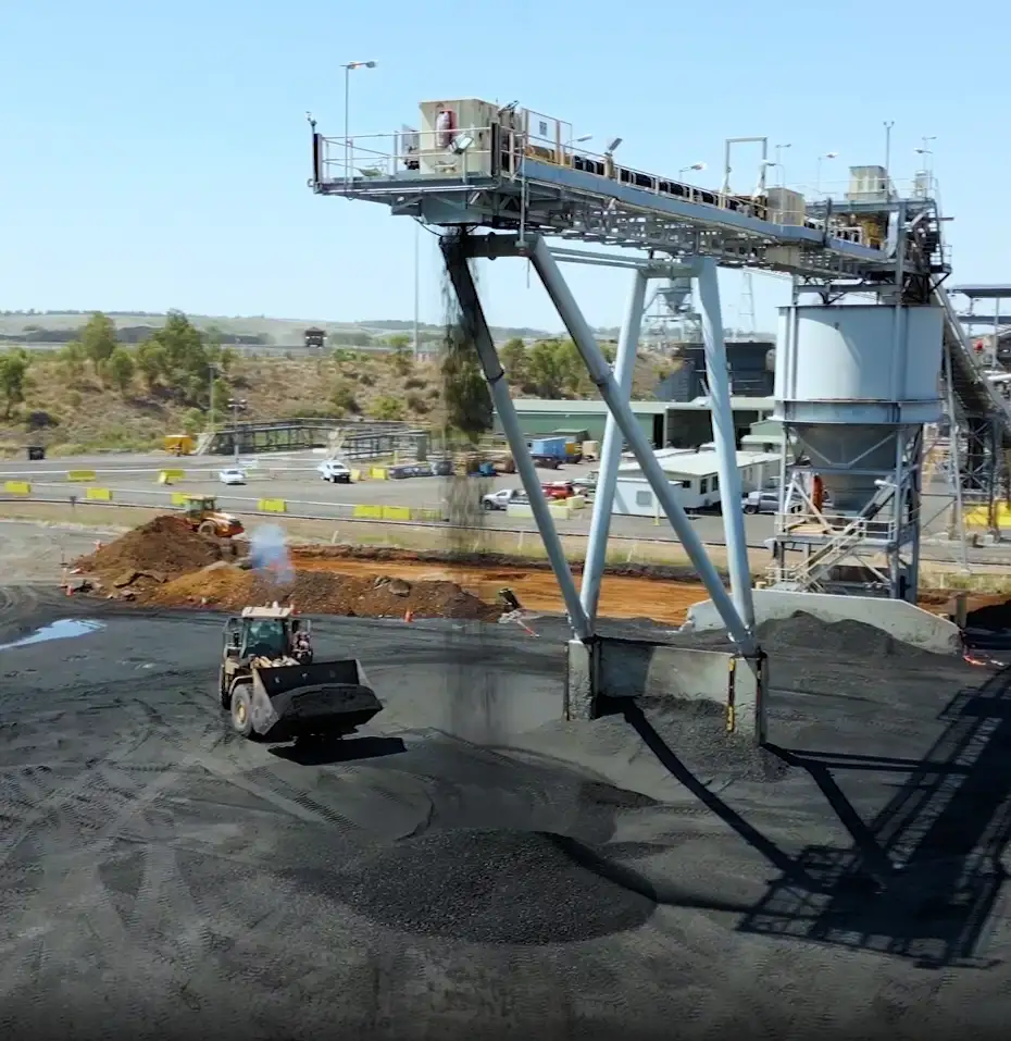
New Hope Group is an Australian coal mining company operating in Queensland. The New Acland Coal (NAC) Mine manages the full range of surface mining activities including excavation, overburden management, environmental compliance, and mine planning. For a site like NAC, spatial data is not a background administrative function. It sits at the centre of every daily operational decision, determining where the diggers go, what land can be cleared, what falls within an Environmental Authority boundary, and what cannot be touched.

The Challenge
For as long as anyone on site could remember, permits at NAC had been managed on paper. Martin Leggat, Short-Term Mine Planner and Surveyor at NAC, described the process plainly, "It was a paper-based thing. We had all sorts of troubles losing the actual paper copies, permits not going to the right people, the right checks weren't being made. There were a lot of shortcuts that were being taken."
The consequences of those shortcuts were not abstract. The site was running environmental compliance checks against the wrong datasets. Multiple versions of spatial files existed across multiple systems simultaneously, with no central authority over which one was current and no way to trace where an error had entered the process.
The site operates on AGD 84 datum while government departments require data in GDA 94, or more recently GDA 2020. At the scale of a mine site, those datum differences translate to positional errors of up to 200 metres. The practical risk was that a drill hole could be placed on a neighbouring property, or mining activity could push outside the Environmental Authority boundary, with the team having no reliable mechanism to catch the error before it became a breach. Martin described just how close the situation had come to exactly that.
- Martin Leggat, Short-Term Mine Planner, New Hope Group
The environmental team, who carried the compliance accountability day to day, had no independent way to check constraint data. Every query had to be routed back to the survey team. The back-and-forth between teams added friction to every operational planning decision and created a dependency that was consuming time on both sides.
It was the combination of these risks coming to a head that forced the decision.
Working With COSOL
When New Acland came out of Care and Maintenance and the decision was made to replace the paper permit process, the site team engaged COSOL to design and implement a solution. What gave the team confidence early was not a presentation or a proposal. It was how the work actually ran from the first meeting forward.
- Martin Leggat, Short-Term Mine Planner, New Hope Group
That responsiveness extended beyond project meetings and into the day-to-day working relationship that followed go-live. For a small site team managing a complex system, the availability of the people behind it matters as much as the quality of the build.
The Approach
COSOL's GIS team, with a combined 50 years of experience in spatial data and asset management, was engaged to design and implement a cloud-based solution built on Esri ArcGIS. The scope covered two connected components: a Permit Management System to replace the paper-based approval process, and a Spatial Viewer that would serve as the single, authoritative source of spatial data for the entire site.
The design principle was deliberate. Rather than asking people to check the right dataset or follow the right process from memory, the system was built so that the correct outcome happened by design. Datum conversion happens automatically on data ingestion. Environmental constraints are captured at the point of permit creation. Every approval is traceable. Every spatial file attached to a permit is validated before the process moves forward.
For a site where a 200-metre datum error had previously created near-miss compliance risk, this was not a feature. It was the point.
The permit workflow was rebuilt from the ground up. What had previously moved on paper through an uncontrolled sequence of desks and sign-offs was replaced with a digital process in which every stage is recorded and every check is enforced. The environmental team can now access all constraint data directly through the Spatial Viewer without routing requests through the survey team. The survey team retains control over what enters the system, which protects data integrity without making them a bottleneck for every downstream query.
Martin arrived at the engagement with no prior ArcGIS experience. The COSOL team worked through training progressively, building his capability alongside the system rather than delivering a completed product and stepping back. The breadth of knowledge required was not trivial.
- Martin Leggat, Short-Term Mine Planner, New Hope Group
The early stages required real commitment from the NAC team. Martin was candid about what that looked like from his side.
Business Impact
The most immediate change was the elimination of the data integrity problem that had defined the previous process. There is now one authoritative source of spatial data on site, and Martin described what that single change meant in practice.
- Martin Leggat, Short-Term Mine Planner, New Hope Group
The environmental team now operates with a level of independence that was not possible under the paper process. Every constraint check that previously required a request back to the survey team is now handled directly through the Spatial Viewer. The back-and-forth that previously added time and friction to operational planning has been largely removed. The environmental advisors know where to go, the data is there, and they can run their constraints reporting without waiting on anyone.
The system is also being used in ways that were not part of the original scope. Annual mine plans, previously produced in mining-specific software, are now produced in ArcGIS Pro. Data sharing with external parties has become more straightforward, because the system can export into formats that third-party CAD packages and government agencies can receive directly. What is clear is that NAC has not come close to the ceiling of what the platform can do.
- Martin Leggat, Short-Term Mine Planner, New Hope Group
New Hope Group's sister company, Bengalla, came onto the same platform after seeing what NAC had built and has since extended the use case further into field-based data capture for environmental staff working in the pit.
When asked to reflect on the return on investment, Martin did not reach for an efficiency metric. He went straight to what the system is ultimately protecting against.
Key outcomes at a glance
- Paper-based permit process replaced with a fully digital, spatially grounded permit lifecycle
- Environmental team now self-sufficient for constraint checking, reducing dependency on the survey team
- Datum conversion errors eliminated through automated coordinate system alignment on data ingestion
- Single source of truth established with controlled data entry and full audit trail
- Annual mine plans now produced in ArcGIS Pro, removing reliance on a separate mining software workflow
- External data sharing improved through ArcGIS export capability compatible with third-party formats
- Sister company Bengalla adopted the same platform following NAC's implementation
About COSOL
COSOL is built on one belief: in asset-centric industries, reliability is everything. We're a trusted, data-led asset management partner for organisations around the world who can't afford to fail. And known for our deep expertise, dependable delivery, and ability to keep critical assets performing at their best.
The company recently celebrated 25 years in business and recognised as reliable partners by their clients across the globe.