With the release of 10.7 in March 2019 we saw the expansion of user types (Viewer, Editor, Field Worker, Creator and GIS Professional), and the introduction of ArcGIS Notebook Server and Webhooks. The 10.7.1 update continues the ESRI architecture evolution. Key updates include:
- New options to publish your data in bulk
- Flexible administrator roles
- Dynamic aggregation of data
- Redesigned upload experience
New options to publish your data in bulk
This functionality allows you to publish data in bulk from enterprise geodatabases, folders and cloud stores with several clicks. This will allow you, for example, to search and discover all of your datasets residing on your enterprise geodatabases and use them in maps and apps, without requiring direct access to the database. Previously, if you wanted to expose all of your geodatabase data as services and layers, you would need to author and publish them to the portal from ArcGIS Pro or ArcMap.
Flexible administrator roles
There is now more flexibility for allowing users to manage the administration of your organisation. You can create custom roles that include administrative privileges to manage the portal settings. This allows administrators to delegate a specific set of administrative tasks to users without giving them the full set of privileges in the default administrator role. For example, a user with a custom role which includes the Organisation website privilege will have the ability to manage the portal’s website settings without the ability to perform other administrative tasks, such as managing security or server settings. This will allow administrators to better manage and share tasks related to the administration of your organisation.

Dynamic aggregation of data
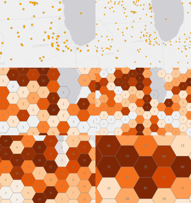
Feature binning is a visualisation tool that allows you to explore large datasets while optimising the drawing performance of layers that contain thousands or millions of point features. Bin-enabled layers can be published by ArcGIS Pro 2.4 as map image layers to ArcGIS Enterprise 10.7.1 portals, or as map services to stand-alone ArcGIS Server 10.7.1 sites. This will simplify the publishing and visualisation of large datasets.
Redesigned upload experience
At 10.7.1 Esri has increased the size limit of what you can upload to 200 GB (up from 1 GB). When uploading items, you can also see the progress of your upload via a status bar. This is especially helpful when uploading those larger datasets.
Earlier this year, Esri also introduced changes to the ArcGIS Enterprise product lifecycle. Anyone who plans, builds and maintains ArcGIS Enterprise deployments needs to understand this new product lifecycle in order to pick the right release. While 10.7 was issued as a short-term support release, 10.7.1 is a long-term support release, meaning it will receive a full six years of support, including four years of patches and updates.
Sites that prefer to stay on a single release in an environment with a minimum of changes over a number of years are best served by a long-term support release, making 10.7.1 an appealing upgrade option.
Overall, 10.7.1 delivers a range of new possibilities for data and services. Review the release announcement here, or download the full list of issues addressed.

